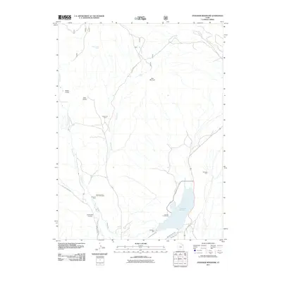
2011 Map of Steinaker Reservoir
USGS Topo · Published 2011About this map
The Dry Fork Canyon Indian Petroglyphs anchor the cultural landscape of this high-desert region, situated near the McConkie Ranch where the terrain transitions toward the dramatic Ashley Gorge. This 2011 survey details a complex irrigation and water management network essential to Uintah County, centered on the Steinaker Reservoir and its supporting infrastructure. Water distribution is traced through the Steinaker Feeder Canal, Steinaker Service Canal, and the Steinaker Ditch, illustrating how the arid valley floor is managed below Red Mountain. The map also captures several natural water sources such as Single Trough Spring and Snider Spring, alongside recreational and agricultural landmarks like the Steinaker Campground and the Spring Creek Corral, providing a clear view of how public land use and private ranching coexist.
Find a feature on this map
26 named features on this map. Tap any name to fly to it.
Don’t see what you’re looking for? This feature index may not catch every label — zoom into the map to look around manually.
Map Details
Editions of this 2011 Steinaker Reservoir Map
This is the sole edition of this map. No revisions or reprints were ever made.
Other maps of this area

1885 · Ashley
USGS Topo · 1:250,000

1906 · Marsh Peak
USGS Topo · 1:125,000

1907 · Jensen
USGS Topo · 1:125,000

1908 · Marsh Peak
USGS Topo · 1:125,000

1910 · Jensen
USGS Topo · 1:125,000

1917 · Vernal
USGS Topo · 1:125,000

1950 · Burnt Cabin Gorge
USGS Topo · 1:24,000

1950 · Dyer Mountain
USGS Topo · 1:24,000

1954 · Vernal
USGS Topo · 1:250,000

1958 · Vernal
USGS Topo · 1:250,000