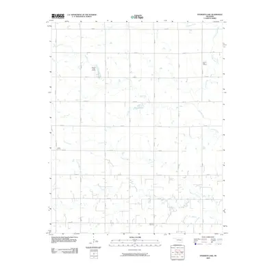
2009 Map of Steinerts Lake
USGS Topo · Published 2009About this map
Pleasant Valley Cemetery and Bison Cemetery sit within a landscape defined by an extensive network of prairie waterways in Garfield County. The drainage pattern is complex, with Skeleton Creek and Rock Creek winding through a grid of rural section roads such as E0550 Rd and S 30th St. This 2009 survey illustrates the persistent agricultural character of the region, where small private landmarks like the Steinert Lakes Airport and its namesake Steinert Lake are integrated into the section lines.
Find a feature on this map
29 named features on this map. Tap any name to fly to it.
Don’t see what you’re looking for? This feature index may not catch every label — zoom into the map to look around manually.
Map Details
Editions of this 2009 Steinerts Lake Map
This is the sole edition of this map. No revisions or reprints were ever made.
Other maps of this area

1893 · Lovell
USGS Topo · 1:62,500

1893 · Hennessey
USGS Topo · 1:62,500

1955 · Enid
USGS Topo · 1:250,000

1956 · Garber
USGS Topo · 1:62,500

1956 · Hennessey
USGS Topo · 1:62,500

1956 · Enid
USGS Topo · 1:62,500

1958 · Enid
USGS Topo · 1:250,000

1974 · Marshall West
USGS Topo · 1:24,000
1974 · Lovell
USGS Topo · 1:24,000
1982 · Bison
USGS Topo · 1:24,000