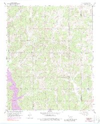
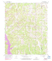
1956 Map of Stella
USGS Topo · Published 1988About this map
Indian Meridian forms the western boundary of this territory, where the rural landscape of eastern Cleveland County meets the Lake Thunderbird shoreline. The settlement at Stella serves as a local focal point, characterized by the Stella Cem and several active Oil Wells that underscore the region's mid-century petroleum interests. The topography is defined by the Little River drainage system, with numerous seasonal watercourses like Hog Creek and Willow Branch carving through the wooded terrain.
Find a feature on this map
16 named features on this map. Tap any name to fly to it.
Don’t see what you’re looking for? This feature index may not catch every label — zoom into the map to look around manually.
Map Details
Editions of this 1956 Stella Map
5 editions found
Other maps of this area

1892 · Moore
USGS Topo · 1:62,500

1893 · Norman
USGS Topo · 1:62,500

1898 · Purcell
USGS Topo · 1:125,000

1910 · McComb
USGS Topo · 1:62,500

1930 · McLoud
USGS Topo · 1:62,500

1934 · Moore
USGS Topo · 1:62,500

1936 · Norman
USGS Topo · 1:62,500

1938 · Moore
USGS Topo · 1:62,500

1954 · Oklahoma City
USGS Topo · 1:250,000
1956 · Choctaw
USGS Topo · 1:24,000