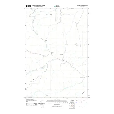
2011 Map of Stember Creek
USGS Topo · Published 2011About this map
Alpowa Creek and its surrounding canyons define this corner of Asotin County, where the landscape is marked by deep gulches and high, narrow ridges. In the early 21st century, the area remains dominated by its physical geography, with small settlements like Valentine and Alpowa connected by winding routes such as Howell Grade Rd and Valentine Ridge Rd. The map illustrates a drainage system flowing toward the Snake River, characterized by features like South Deadman Creek and Stember Creek. Notable terrain features include Valentine Ridge, Knotgrass Ridge, and Flerchinger Ridge, which separate the various drainages. Smaller landforms like Driscoll Gulch and Megginson Gulch add detail to the complex network of ravines that define this section of the Washington landscape.
Find a feature on this map
22 named features on this map. Tap any name to fly to it.
Don’t see what you’re looking for? This feature index may not catch every label — zoom into the map to look around manually.
Map Details
Editions of this 2011 Stember Creek Map
This is the sole edition of this map. No revisions or reprints were ever made.
Other maps of this area

1910 · Pullman
USGS Topo · 1:125,000

1943 · Peola
USGS Topo · 1:62,500

1945 · Clarkston
USGS Topo · 1:62,500

1946 · Peola
USGS Topo · 1:62,500

1948 · Clarkston
USGS Topo · 1:62,500

1955 · Pullman
USGS Topo · 1:250,000

1958 · Pullman
USGS Topo · 1:250,000

1964 · Kirby
USGS Topo · 1:24,000

1964 · Colton
USGS Topo · 1:24,000

1964 · Bishop
USGS Topo · 1:24,000