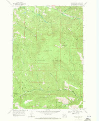
1968 Map of Stemple Pass
USGS Topo · Published 1971About this map
The Continental Divide dictates the rugged character of this Lewis and Clark County landscape, where the headwaters of the Blackfoot River meet high mountain crossings. High-altitude passages such as Flesher Pass and Stemple Pass serve as the primary conduits through the Helena National Forest, connecting the remote mining settlements of Gould and Prospect. These small outposts, located in the southern portion of the sheet, reflect a late-1960s snapshot of Montana's mountain economy, where small-scale mining and resource extraction shaped the local infrastructure.
Find a feature on this map
26 named features on this map. Tap any name to fly to it.
Don’t see what you’re looking for? This feature index may not catch every label — zoom into the map to look around manually.
Map Details
Editions of this 1968 Stemple Pass Map
3 editions found
Other maps of this area

1889 · Helena
USGS Topo · 1:250,000

1893 · Helena
USGS Topo · 1:250,000

1899 · Helena
USGS Topo · 1:250,000

1903 · Coopers Lake
USGS Topo · 1:125,000

1903 · Helena
USGS Topo · 1:250,000

1943 · Hogan
USGS Topo · 1:125,000

1947 · Butte
USGS Topo · 1:250,000

1955 · Choteau
USGS Topo · 1:250,000

1957 · Choteau
USGS Topo · 1:250,000

1958 · Butte
USGS Topo · 1:250,000