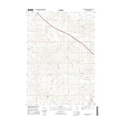
2015 Map of Stenulson Coulee
USGS Topo · Published 2015About this map
Stenulson Coulee carves through the central portion of this Jackson County landscape, representing the distinct drainage patterns of the Driftless Area. The terrain is defined by a series of steep ridges and valleys, with Cloverdale Valley providing a level break in the topography to the south. Three local burial grounds—Pine Creek Cem, County Farm Cem, and Stiehl Cem—are dispersed across the various townships, offering primary data points for genealogists. Waterways like the St Br Trempealeau River and numerous tributaries such as Tank Cr and Pappose Cr dictate the layout of the rural road network. Modern features like the Lewis Airport contrast with the older agricultural land divisions, while Hawk Island stands as a landform feature in the southeast corner near the convergence of several spring-fed creeks.
Find a feature on this map
79 named features on this map. Tap any name to fly to it.
Don’t see what you’re looking for? This feature index may not catch every label — zoom into the map to look around manually.
Map Details
Editions of this 2015 Stenulson Coulee Map
This is the sole edition of this map. No revisions or reprints were ever made.
Other maps of this area

1924 · Black River Falls
USGS Topo · 1:62,500

1926 · Black River Falls
USGS Topo · 1:62,500

1926 · North Bend
USGS Topo · 1:62,500

1927 · Blair
USGS Topo · 1:62,500

1928 · Melrose
USGS Topo · 1:48,000

1929 · North Bend
USGS Topo · 1:62,500

1949 · Melrose
USGS Topo · 1:62,500

1953 · Eau Claire
USGS Topo · 1:250,000

1958 · Eau Claire
USGS Topo · 1:250,000

1964 · Eau Claire
USGS Topo · 1:250,000