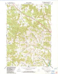
1984 Map of Stenulson Coulee
USGS Topo · Published 1984About this map
The branching ravines of Stenulson Coulee and numerous creek valleys define the transition from the rolling uplands of Jackson County into the Black River State Forest. In the mid-1980s, the landscape was a mosaic of agricultural plots and dense woodland, connected by a network of named country roads such as Sand Prairie Road and Squirrel Road. Small settlements like Adams and Cloverdale appear alongside evidence of local industry, including Charcoal Kilns and scattered Shale Pits. Genealogy researchers can find several burial grounds across the townships of Alma, Hixton, and Albion, including the Pine Creek Cem, Squaw Cr Cem, and the County Farm Cem. The topography is particularly detailed along Squaw Creek and the Br Trempealeau R, showing the intricate drainage patterns that shaped local land use and farm placement.
Find a feature on this map
49 named features on this map. Tap any name to fly to it.
Don’t see what you’re looking for? This feature index may not catch every label — zoom into the map to look around manually.
Map Details
Editions of this 1984 Stenulson Coulee Map
This is the sole edition of this map. No revisions or reprints were ever made.
Other maps of this area

1924 · Black River Falls
USGS Topo · 1:62,500

1926 · Black River Falls
USGS Topo · 1:62,500

1926 · North Bend
USGS Topo · 1:62,500

1927 · Blair
USGS Topo · 1:62,500

1928 · Melrose
USGS Topo · 1:48,000

1929 · North Bend
USGS Topo · 1:62,500

1949 · Melrose
USGS Topo · 1:62,500

1953 · Eau Claire
USGS Topo · 1:250,000

1958 · Eau Claire
USGS Topo · 1:250,000

1964 · Eau Claire
USGS Topo · 1:250,000