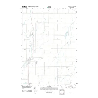
2011 Map of Stephenson
USGS Topo · Published 2011About this map
Stephenson and Daggett anchor this Menominee County landscape, situated along the north-south transport corridor defined by the Little Cedar River. The area is marked by a significant concentration of local burial grounds, including the Danish Cemetery, Bethlehem Covenant Cemetery, and North Stephenson Cemetery, reflecting the immigrant heritage and community centers of this Upper Peninsula region. In the northern reaches, Hays Creek and Hugos Brook drain into the river valley, while the Stephenson Lookout Tower stands as a landmark of forest management history. Rural life centers on small hubs like Palestine and Ingalls, each served by its own post office, such as the Daggett Post Office and Stephenson Post Office. Recreational landmarks like Peterson Park and the Indian Hills Golf Course sit alongside the winding river, which remains the primary geographical feature shaping the settlement pattern between these small Michigan townships.
Find a feature on this map
24 named features on this map. Tap any name to fly to it.
Don’t see what you’re looking for? This feature index may not catch every label — zoom into the map to look around manually.
Map Details
Editions of this 2011 Stephenson Map
This is the sole edition of this map. No revisions or reprints were ever made.
Other maps of this area

1949 · Stephenson
USGS Topo · 1:48,000

1954 · Escanaba
USGS Topo · 1:250,000

1957 · Escanaba
USGS Topo · 1:250,000

1958 · Escanaba
USGS Topo · 1:250,000

1963 · Bark River
USGS Topo · 1:62,500

1963 · Powers
USGS Topo · 1:62,500

1963 · Cedar River
USGS Topo · 1:62,500

1963 · Stephenson
USGS Topo · 1:62,500

1981 · Marinette
USGS Topo · 1:100,000

1982 · Escanaba
USGS Topo · 1:100,000