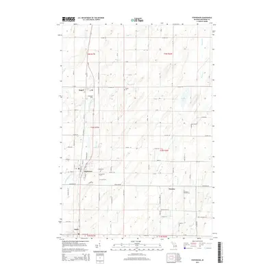
2014 Map of Stephenson
USGS Topo · Published 2014About this map
The Little Cedar River and its various tributaries, including Hays Cr and Hugos Brook, define the drainage patterns of this rural Menominee County landscape. This 2014 survey documents the linear settlement pattern along the Us-41 corridor, connecting the communities of Daggett, Stephenson, and Ingalls. The abundance of cemeteries in this area, such as the Bethlehem Covenant Cem, Danish Cem, and N Stephenson Cem, provides a significant record of the local genealogy and the diverse cultural heritage of the township's early residents. Beyond the primary thoroughfares like Co Road 358 and Cedar River RD, the map details a grid of local connectors including Anderson Road N-1 and S Frenchtown Rd. Recreational and community landmarks like Peterson Park and Wagner Lake appear alongside essential infrastructure, reflecting the modern character of these long-established Upper Peninsula villages.
Find a feature on this map
97 named features on this map. Tap any name to fly to it.
Don’t see what you’re looking for? This feature index may not catch every label — zoom into the map to look around manually.
Map Details
Editions of this 2014 Stephenson Map
This is the sole edition of this map. No revisions or reprints were ever made.
Other maps of this area

1949 · Stephenson
USGS Topo · 1:48,000

1954 · Escanaba
USGS Topo · 1:250,000

1957 · Escanaba
USGS Topo · 1:250,000

1958 · Escanaba
USGS Topo · 1:250,000

1963 · Bark River
USGS Topo · 1:62,500

1963 · Powers
USGS Topo · 1:62,500

1963 · Cedar River
USGS Topo · 1:62,500

1963 · Stephenson
USGS Topo · 1:62,500

1981 · Marinette
USGS Topo · 1:100,000

1982 · Escanaba
USGS Topo · 1:100,000