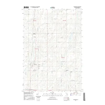
2017 Map of Stephenson
USGS Topo · Published 2017About this map
Stephenson and Daggett serve as the primary hubs in this southern Menominee County landscape, situated along the north-south transport corridor that follows the Little Cedar River. The settlement pattern reflects the area's agricultural and rural character, with many farm-to-market roads such as Belgiumtown Rd and Wangerin Rd cutting across the terrain. Of particular interest to genealogists is the density of local burial sites, including the Danish Cem and Stephenson Cem north of the village center, and the Bethlehem Covenant Cem further east near the community of Palestine. The geography is defined by a network of drainage ways like Hugos Brook and Grant Brook, which feed into the larger river systems and punctuate the low-lying wetlands that characterize much of this Upper Peninsula region.
Find a feature on this map
58 named features on this map. Tap any name to fly to it.
Don’t see what you’re looking for? This feature index may not catch every label — zoom into the map to look around manually.
Map Details
Editions of this 2017 Stephenson Map
This is the sole edition of this map. No revisions or reprints were ever made.
Other maps of this area

1949 · Stephenson
USGS Topo · 1:48,000

1954 · Escanaba
USGS Topo · 1:250,000

1957 · Escanaba
USGS Topo · 1:250,000

1958 · Escanaba
USGS Topo · 1:250,000

1963 · Bark River
USGS Topo · 1:62,500

1963 · Powers
USGS Topo · 1:62,500

1963 · Cedar River
USGS Topo · 1:62,500

1963 · Stephenson
USGS Topo · 1:62,500

1981 · Marinette
USGS Topo · 1:100,000

1982 · Escanaba
USGS Topo · 1:100,000