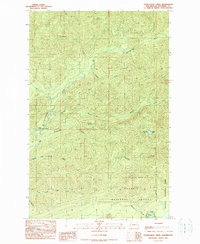
1990 Map of Stequaleho Creek
USGS Topo · Published 1990About this map
Olympic National Park and Olympic National Forest converge in this Jefferson County landscape, where the confluence of several major waterways defines the topography. The Clearwater River and Queets River serve as primary drainages, joined by the Solleks River and the meandering Stequaleho Creek. The presence of multiple Borrow Pits suggests localized resource extraction or road-building activity within the forest during the late 20th century. Remote recreation sites are prominent, including the Upper Clearwater Campground and the high-elevation Yahoo Lake Campground near Yahoo Lake. Navigational points such as Sams Rapids on the Queets and the distinctive Kunamaksit terrain feature highlight the transition from managed forest lands to the protected wilderness of the national park boundary.
Find a feature on this map
19 named features on this map. Tap any name to fly to it.
Don’t see what you’re looking for? This feature index may not catch every label — zoom into the map to look around manually.
Map Details
Editions of this 1990 Stequaleho Creek Map
This is the sole edition of this map. No revisions or reprints were ever made.
Other maps of this area

1939 · Mount Tom
USGS Topo · 1:62,500

1943 · Spruce Mountain
USGS Topo · 1:62,500

1943 · Copalis Beach
USGS Topo · 1:250,000

1951 · Copalis Beach
USGS Topo · 1:250,000

1956 · Kloochman Rock
USGS Topo · 1:62,500

1956 · Mount Tom
USGS Topo · 1:62,500

1956 · Spruce Mtn.
USGS Topo · 1:62,500

1956 · Salmon River
USGS Topo · 1:62,500
1957 · Mount Tom
USGS Topo · 1:62,500

1957 · Copalis Beach
USGS Topo · 1:250,000