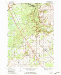
1968 Map of Sterling
USGS Topo · Published 1984About this map
The Deep River Gas and Oil Field dominates the eastern portion of this landscape, reflecting the industrial character of Arenac County in the late 1960s. The village of Sterling serves as a local hub, situated where the Penn Central railroad cuts through the terrain. To the north and west, the Au Sable State Forest provides a sharp contrast to the developed oil fields, with drainage provided by the winding Rifle River and its numerous tributaries like Wells Creek.
Find a feature on this map
42 named features on this map. Tap any name to fly to it.
Don’t see what you’re looking for? This feature index may not catch every label — zoom into the map to look around manually.
Map Details
Editions of this 1968 Sterling Map
2 editions found

Other maps of this area

1954 · Traverse City
USGS Topo · 1:250,000

1954 · Midland
USGS Topo · 1:250,000

1954 · Flint
USGS Topo · 1:250,000

1954 · Tawas City
USGS Topo · 1:250,000

1958 · Traverse City
USGS Topo · 1:250,000

1958 · Flint
USGS Topo · 1:250,000

1958 · Tawas City
USGS Topo · 1:250,000

1958 · Midland
USGS Topo · 1:250,000

1959 · Midland
USGS Topo · 1:250,000

1966 · Midland
USGS Topo · 1:250,000