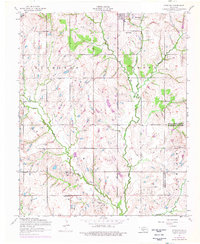
1956 Map of Sterling
USGS Topo · Published 1976About this map
Beaver Creek and Ninemile Creek dominate this mid-century landscape on the border of Comanche and Stephens Counties. The town of Sterling is the primary hub, anchored by its High School and the nearby Sterling Cemetery. The surrounding prairie is characterized by a mix of agricultural sections and growing industrial activity, notably the prominent Oil Field and numerous scattered Oil wells connected by a complex Pipeline network.
Find a feature on this map
19 named features on this map. Tap any name to fly to it.
Don’t see what you’re looking for? This feature index may not catch every label — zoom into the map to look around manually.
Map Details
Editions of this 1956 Sterling Map
2 editions found
Other maps of this area

1946 · Lawton
USGS Topo · 1:62,500

1949 · Arbuckle Hill
USGS Topo · 1:24,000

1949 · Cement
USGS Topo · 1:62,500

1949 · Elgin
USGS Topo · 1:24,000

1949 · Nellie
USGS Topo · 1:62,500

1955 · Lawton
USGS Topo · 1:250,000

1956 · Sterling
USGS Topo · 1:24,000

1956 · Ninemile Creek
USGS Topo · 1:24,000

1956 · Fletcher
USGS Topo · 1:24,000

1956 · Arbuckle Hill
USGS Topo · 1:24,000