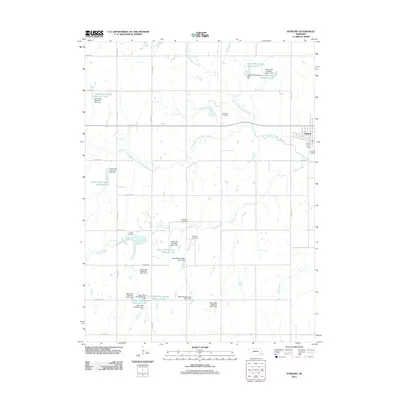
2011 Map of Sterling
USGS Topo · Published 2011About this map
Sterling serves as the primary hub of this eastern Nebraska landscape, situated along the North Fork Big Nemaha River and the Middle Branch Big Nemaha River. The area is characterized by an extensive water management system, featuring numerous numbered dams and reservoirs like Upper Big Nemaha Reservoir G-19 and Upper Big Nemaha Dam G-31. This infrastructure underscores the agricultural importance of the watershed at the start of the 2010s.
Find a feature on this map
42 named features on this map. Tap any name to fly to it.
Don’t see what you’re looking for? This feature index may not catch every label — zoom into the map to look around manually.
Map Details
Editions of this 2011 Sterling Map
This is the sole edition of this map. No revisions or reprints were ever made.
Other maps of this area

1897 · Lincoln
USGS Topo · 1:125,000

1903 · Weeping Water
USGS Topo · 1:125,000

1929 · Weeping Water
USGS Topo · 1:125,000

1955 · Lincoln
USGS Topo · 1:250,000

1957 · Lincoln
USGS Topo · 1:250,000

1958 · Lincoln
USGS Topo · 1:250,000

1965 · Adams
USGS Topo · 1:24,000

1965 · Crab Orchard
USGS Topo · 1:24,000

1965 · Sterling
USGS Topo · 1:24,000
1965 · Firth
USGS Topo · 1:24,000