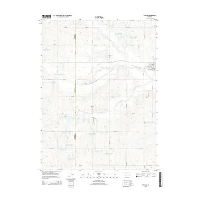
2014 Map of Sterling
USGS Topo · Published 2014About this map
The village of Sterling anchors this agricultural region in Johnson County, where a grid of rural roads such as Cherry Rd and Buckeye Rd defines the prairie landscape. The area is heavily marked by water management projects, featuring numerous numbered catchments like Upper Big Nemaha Reservoir J-34 and Upper Big Nemaha Reservoir G-19 that support the local watershed. These reservoirs sit along the complex drainages of the North Fork Big Nemaha River and its various tributaries.
Find a feature on this map
51 named features on this map. Tap any name to fly to it.
Don’t see what you’re looking for? This feature index may not catch every label — zoom into the map to look around manually.
Map Details
Editions of this 2014 Sterling Map
This is the sole edition of this map. No revisions or reprints were ever made.
Other maps of this area

1897 · Lincoln
USGS Topo · 1:125,000

1903 · Weeping Water
USGS Topo · 1:125,000

1929 · Weeping Water
USGS Topo · 1:125,000

1955 · Lincoln
USGS Topo · 1:250,000

1957 · Lincoln
USGS Topo · 1:250,000

1958 · Lincoln
USGS Topo · 1:250,000

1965 · Adams
USGS Topo · 1:24,000

1965 · Crab Orchard
USGS Topo · 1:24,000

1965 · Sterling
USGS Topo · 1:24,000
1965 · Firth
USGS Topo · 1:24,000