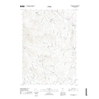
2018 Map of Sterling Mountain
USGS Topo · Published 2018About this map
The Lamoille River cuts through the northern portion of this Lamoille County landscape, serving as a focal point for the historic Waterman Covered Bridge and the village of Hyde Park. This modern survey illustrates the rugged transition between the valley floor and the high elevations of the Sterling Range, where the terrain rises toward Sterling Mtn and White Rocks. The distribution of cemeteries, such as the Bidwell-French Hill Cem and Sterling Cem, reflects the early upland settlement patterns that once defined the area's rural character before many of these high-elevation areas were integrated into the Green Mountains parklands.
Find a feature on this map
100 named features on this map. Tap any name to fly to it.
Don’t see what you’re looking for? This feature index may not catch every label — zoom into the map to look around manually.
Map Details
Editions of this 2018 Sterling Mountain Map
This is the sole edition of this map. No revisions or reprints were ever made.
Other maps of this area

1919 · Montpelier
USGS Topo · 1:62,500

1921 · Richmond
USGS Topo · 1:48,000

1921 · Montpelier
USGS Topo · 1:62,500

1924 · Camels Hump
USGS Topo · 1:62,500

1925 · Mount Mansfield
USGS Topo · 1:48,000

1927 · Mount Mansfield
USGS Topo · 1:62,500

1927 · Hyde Park
USGS Topo · 1:48,000

1930 · Hyde Park
USGS Topo · 1:62,500
1943 · Hyde Park
USGS Topo · 1:62,500

1944 · Montpelier
USGS Topo · 1:62,500