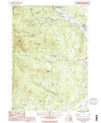
1986 Map of Sterling Mountain
USGS Topo · Published 1987About this map
The Sterling Range and the high ridges of the Green Mountains define this mid-1980s landscape at the intersection of several northern Vermont townships. Much of the western terrain is preserved within the Mt Mansfield State Forest, where notable peaks like Sterling Mtn and White Rocks rise above Beaver Meadow. The human geography is concentrated in the valleys to the east, where the Lamoille River and Little River systems drain the highlands. Local life centers around small clusters such as West Settlement and the curiously named Mud City. Industrial and civil infrastructure is represented by a Quarry near the eastern boundary and a Covered Br crossing Bohannon Brook, reflecting a mix of traditional Vermont character and active resource extraction in the late twentieth century.
Find a feature on this map
41 named features on this map. Tap any name to fly to it.
Don’t see what you’re looking for? This feature index may not catch every label — zoom into the map to look around manually.
Map Details
Editions of this 1986 Sterling Mountain Map
2 editions found
Other maps of this area

1919 · Montpelier
USGS Topo · 1:62,500

1921 · Richmond
USGS Topo · 1:48,000

1921 · Montpelier
USGS Topo · 1:62,500

1924 · Camels Hump
USGS Topo · 1:62,500

1925 · Mount Mansfield
USGS Topo · 1:48,000

1927 · Mount Mansfield
USGS Topo · 1:62,500

1927 · Hyde Park
USGS Topo · 1:48,000

1930 · Hyde Park
USGS Topo · 1:62,500
1943 · Hyde Park
USGS Topo · 1:62,500

1944 · Montpelier
USGS Topo · 1:62,500