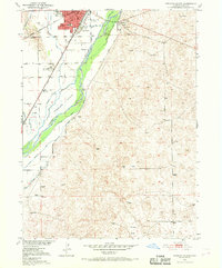
1951 Map of Sterling South
USGS Topo · Published 1969About this map
The industrial and agricultural infrastructure of Sterling dominates the South Platte River valley in this mid-century survey. The local economy is anchored by the prominent Sugar Factory and a network of irrigation works, including the Springdale Ditch, Lowline Ditch, and Sterling No 1 Ditch. These man-made channels divert water across the plains to support the region's beet production and farming operations. The town's civic core is well-defined, featuring the Courthouse, Hospital, and Franklin Sch, while the presence of the Overland Trail Park and Museum and a Historical Monument south of town indicates a community deeply connected to its frontier heritage.
Find a feature on this map
33 named features on this map. Tap any name to fly to it.
Don’t see what you’re looking for? This feature index may not catch every label — zoom into the map to look around manually.
Map Details
Editions of this 1951 Sterling South Map
4 editions found
Other maps of this area

1951 · Reiradon Hill
USGS Topo · 1:24,000

1951 · Sterling South
USGS Topo · 1:24,000

1951 · Sterling North
USGS Topo · 1:24,000

1951 · Galien
USGS Topo · 1:24,000

1951 · Atwood NE
USGS Topo · 1:24,000

1951 · Merino
USGS Topo · 1:24,000

1951 · Atwood
USGS Topo · 1:24,000

1954 · Sterling
USGS Topo · 1:250,000

1958 · Sterling
USGS Topo · 1:250,000

1971 · Merino
USGS Topo · 1:24,000