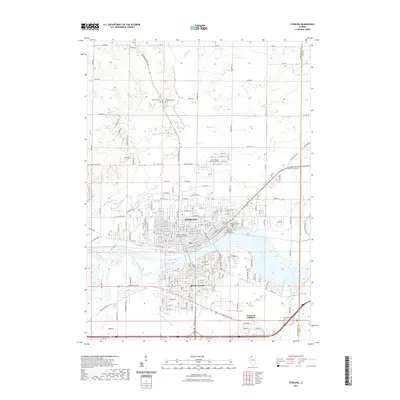
2021 Map of Sterling
USGS Topo · Published 2021About this map
Sterling and Rock Falls dominate this section of the Rock River valley, where urban development is closely tied to the waterway and its industrial history. The map shows the dense residential grids of both cities, connected by several crossings, while the southern edge features the Yeoward Addition near Crystal Lake. This modern survey illustrates the significant water management infrastructure of the region, including the Union Drainage Ditch and Threemile Br. Local historians will find a concentrated cluster of historic burial sites, ranging from the large Riverside Cem and Calvary Cem near the river to smaller, denominationally specific sites like the Reformed Mennonite Churchyard Cem. To the north, the landscape transitions into agricultural land drained by Elkhorn Creek and Jordan Cr, dotted with family-named roads like Capp Rd and Rick Rd.
Find a feature on this map
78 named features on this map. Tap any name to fly to it.
Don’t see what you’re looking for? This feature index may not catch every label — zoom into the map to look around manually.
Map Details
Editions of this 2021 Sterling Map
This is the sole edition of this map. No revisions or reprints were ever made.
Other maps of this area

1930 · Woodsung
USGS Topo · 1:48,000

1932 · Prophetstown
USGS Topo · 1:48,000

1934 · Morrison
USGS Topo · 1:48,000

1936 · Prophetstown
USGS Topo · 1:62,500

1940 · Morrison
USGS Topo · 1:62,500

1946 · Sterling
USGS Topo · 1:62,500

1948 · Sterling
USGS Topo · 1:62,500

1949 · Walnut
USGS Topo · 1:62,500

1958 · Aurora
USGS Topo · 1:250,000

1961 · Aurora
USGS Topo · 1:250,000