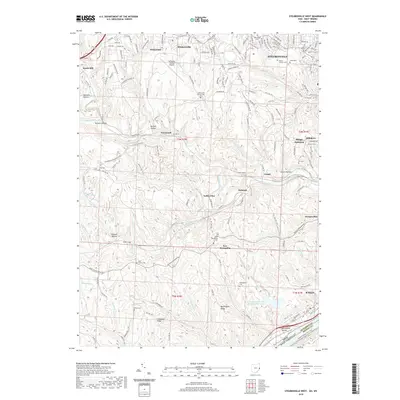
2019 Map of Steubenville West
USGS Topo · Published 2019About this map
Steubenville sits at the eastern edge of this Jefferson County landscape, where the urban street grid gives way to the winding ridges and deep hollows of the Appalachian Plateau. The 2019 data illustrates a region defined by its complex topography and industrial legacy, notably at the Cardinal Fly Ash Retention Reservoir near Brilliant. A network of tunnels including Gould Tunnel, Adams Tunnel, and Hunter Tunnel shows the historical engineering required to move people and goods through the dissected terrain of Chestnut Ridge and Buckingham Ridge.
Find a feature on this map
77 named features on this map. Tap any name to fly to it.
Don’t see what you’re looking for? This feature index may not catch every label — zoom into the map to look around manually.
Map Details
Editions of this 2019 Steubenville West Map
This is the sole edition of this map. No revisions or reprints were ever made.
Other maps of this area

1901 · Cadiz
USGS Topo · 1:62,500

1902 · Wheeling
USGS Topo · 1:62,500

1903 · Cadiz
USGS Topo · 1:62,500

1904 · Steubenville
USGS Topo · 1:62,500

1905 · St. Clairsville
USGS Topo · 1:62,500

1935 · Wheeling
USGS Topo · 1:62,500

1935 · Steubenville
USGS Topo · 1:62,500

1942 · Wheeling
USGS Topo · 1:62,500

1942 · Steubenville
USGS Topo · 1:62,500

1951 · Canton
USGS Topo · 1:250,000