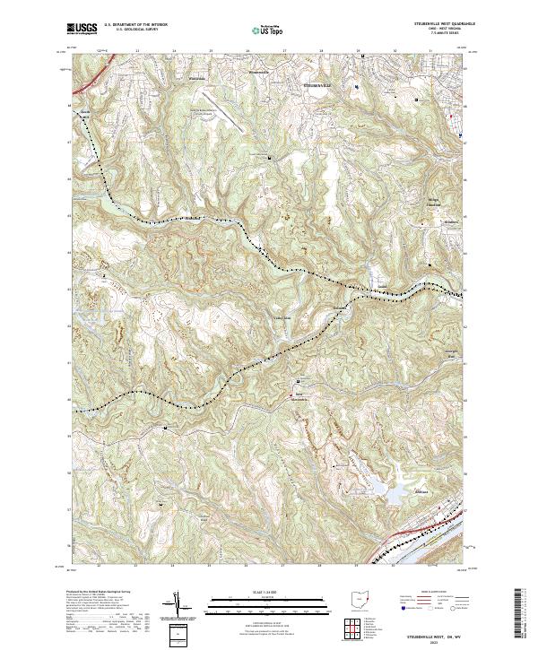
2023 Map of Steubenville West
USGS Topo · Published 2023About this map
Cross Creek meanders through the heart of Jefferson County, dividing a landscape defined by deep ridges and small hilltop communities. In the north, Wintersville and Winterdale mark a transition toward the urban center of Steubenville, while the southern reaches remain dominated by topographical landmarks like Chestnut Ridge and Buckingham Ridge. The industrial footprint of the Ohio River valley is evident at the Cardinal Fly Ash Retention Reservoir near Brilliant, contrasting with the more rural character of settlements like New Alexandria and Fernwood. Genealogists will find a high density of burial sites across the quadrangle, from the Cross Creek Presbyterian Cem to the isolated Oliver Cem and Tent Church Cem, each providing geographic anchors for local family histories near the West Virginia border.
Find a feature on this map
170 named features on this map. Tap any name to fly to it.
Don’t see what you’re looking for? This feature index may not catch every label — zoom into the map to look around manually.
Map Details
Editions of this 2023 Steubenville West Map
This is the sole edition of this map. No revisions or reprints were ever made.
Other maps of this area

1901 · Cadiz
USGS Topo · 1:62,500

1902 · Wheeling
USGS Topo · 1:62,500

1903 · Cadiz
USGS Topo · 1:62,500

1904 · Steubenville
USGS Topo · 1:62,500

1905 · St. Clairsville
USGS Topo · 1:62,500

1935 · Wheeling
USGS Topo · 1:62,500

1935 · Steubenville
USGS Topo · 1:62,500

1942 · Wheeling
USGS Topo · 1:62,500

1942 · Steubenville
USGS Topo · 1:62,500

1951 · Canton
USGS Topo · 1:250,000