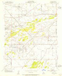
1954 Map of Stevens
USGS Topo · Published 1955About this map
The Kern River meanders through a landscape defined by California's mid-century petroleum boom, where sprawling oil fields and complex industrial infrastructure sit alongside irrigated agriculture. This 1950s survey documents a dense network of pipelines, oil sumps, and tank farms, including the Ten Section Oil Field and the Strand Oil Field. Industrial operations are anchored by the Ten Section Refinery and the Rio Bravo Pumping Sta, reflecting the intensive resource extraction of the era.
Find a feature on this map
31 named features on this map. Tap any name to fly to it.
Don’t see what you’re looking for? This feature index may not catch every label — zoom into the map to look around manually.
Map Details
Editions of this 1954 Stevens Map
4 editions found
Other maps of this area

1906 · Bakersfield
USGS Topo · 1:62,500

1910 · Buena Vista Lake
USGS Topo · 1:125,000

1912 · Buena Vista Lake
USGS Topo · 1:125,000

1929 · Stevens
USGS Topo · 1:31,680

1929 · Coles Levee
USGS Topo · 1:31,680

1929 · Mouth of Kern
USGS Topo · 1:31,680

1930 · Millux
USGS Topo · 1:31,680

1930 · Rosedale
USGS Topo · 1:31,680

1930 · Conner
USGS Topo · 1:31,680

1930 · Oildale
USGS Topo · 1:31,680