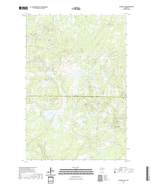
2022 Map of Stewart Lake
USGS Topo · Published 2022About this map
Fifty Lakes serves as the primary settlement within this lake-dense region of Central Minnesota, situated near the boundary between Cass Co and Crow Wing Co. The landscape is dominated by glacial depressions and wetlands, characterized by an intricate network of water bodies including the centrally located Stewart Lake and the oddly named Dirty House Lake. North of the county line, the terrain is dotted with smaller basins like Peterson Lake, Stony Lake, and Lee Lake, while the southern portion features larger reaches such as Clear Lake and Corral Lake.
Find a feature on this map
36 named features on this map. Tap any name to fly to it.
Don’t see what you’re looking for? This feature index may not catch every label — zoom into the map to look around manually.
Map Details
Editions of this 2022 Stewart Lake Map
This is the sole edition of this map. No revisions or reprints were ever made.
Other maps of this area

1953 · Brainerd
USGS Topo · 1:250,000

1957 · Brainerd
USGS Topo · 1:250,000

1958 · Brainerd
USGS Topo · 1:250,000

1959 · Lower Whitefish Lake
USGS Topo · 1:24,000

1959 · Jenkins
USGS Topo · 1:24,000

1960 · Cross Lake
USGS Topo · 1:24,000

1965 · Brainerd
USGS Topo · 1:250,000

1970 · Laura Lake
USGS Topo · 1:24,000
1970 · Mitchell Lake
USGS Topo · 1:24,000

1970 · Woman Lake
USGS Topo · 1:24,000