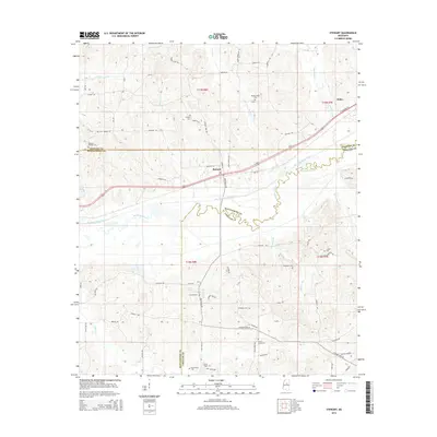
2015 Map of Stewart
USGS Topo · Published 2015About this map
Stewart sits along the northern edge of the Big Black River basin, where the natural meanders of the waterway contrast with the engineered channel of the Big Black River Canal. This 2015 survey reveals a rural landscape deeply rooted in its local geography, where the border of Montgomery, Webster, and Choctaw Counties converges near the river. The map is a vital resource for genealogical research, documenting numerous family and community burial grounds such as Milligan Springs Cem, Sarepta Cem, and Old Antioch Cem. The settlement at Pellez and landmarks like Williams Spring further define the local character. Transportation is centered on U S Highway 82, which cuts through the northern sections, while a network of rural roads like Stewart Lodi Rd and Huntsville Rd provides access to the surrounding creek bottoms and uplands.
Find a feature on this map
75 named features on this map. Tap any name to fly to it.
Don’t see what you’re looking for? This feature index may not catch every label — zoom into the map to look around manually.
Map Details
Editions of this 2015 Stewart Map
This is the sole edition of this map. No revisions or reprints were ever made.
Other maps of this area

1953 · Walthall
USGS Topo · 1:62,500

1953 · West Point
USGS Topo · 1:250,000

1954 · Duck Hill
USGS Topo · 1:62,500

1958 · West Point
USGS Topo · 1:250,000

1963 · West Point
USGS Topo · 1:250,000

1966 · Kilmichael
USGS Topo · 1:24,000

1966 · Poplar Creek
USGS Topo · 1:24,000

1966 · Stewart
USGS Topo · 1:24,000

1966 · Weir
USGS Topo · 1:24,000

1966 · Tomnolen
USGS Topo · 1:24,000