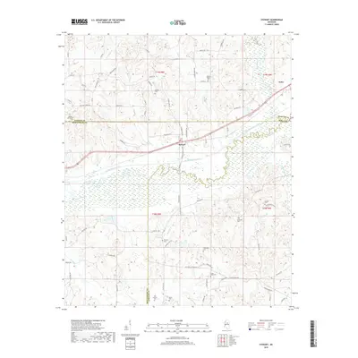
2018 Map of Stewart
USGS Topo · Published 2018About this map
The settlement of Stewart lies at the heart of this landscape, situated along the border of Montgomery and Webster counties. The terrain is characterized by the engineered path of the Big Black River Canal, which cuts a straight line through the wetlands, contrasting with the meandering remnants of the original Big Black River and the swampy grounds of Jacks Slough. Numerous family and community burial sites are scattered throughout the hills and bottoms, including Sarepta Cem, Milligan Springs Cem, and Jenkins Cem, providing a detailed record of local genealogy and land ownership.
Find a feature on this map
82 named features on this map. Tap any name to fly to it.
Don’t see what you’re looking for? This feature index may not catch every label — zoom into the map to look around manually.
Map Details
Editions of this 2018 Stewart Map
This is the sole edition of this map. No revisions or reprints were ever made.
Other maps of this area

1953 · Walthall
USGS Topo · 1:62,500

1953 · West Point
USGS Topo · 1:250,000

1954 · Duck Hill
USGS Topo · 1:62,500

1958 · West Point
USGS Topo · 1:250,000

1963 · West Point
USGS Topo · 1:250,000

1966 · Kilmichael
USGS Topo · 1:24,000

1966 · Poplar Creek
USGS Topo · 1:24,000

1966 · Stewart
USGS Topo · 1:24,000

1966 · Weir
USGS Topo · 1:24,000

1966 · Tomnolen
USGS Topo · 1:24,000