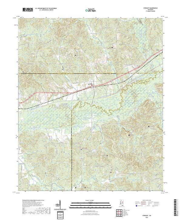
2024 Map of Stewart
USGS Topo · Published 2024About this map
The community of Stewart lies at the intersection of local routes in a landscape defined by the complex hydrology of the Big Black River basin. This survey shows a territory heavily marked by water management, featuring the Big Black River Canal and the Old Channel Big Black River, alongside the Big Bywy Ditch and Jacks Slough. These man-made and natural watercourses suggest a long history of reclaiming bottomlands for agricultural use within the Farm Service Agency Interest of Mississippi lands.
Find a feature on this map
82 named features on this map. Tap any name to fly to it.
Don’t see what you’re looking for? This feature index may not catch every label — zoom into the map to look around manually.
Map Details
Editions of this 2024 Stewart Map
This is the sole edition of this map. No revisions or reprints were ever made.
Other maps of this area

1953 · Walthall
USGS Topo · 1:62,500

1953 · West Point
USGS Topo · 1:250,000

1954 · Duck Hill
USGS Topo · 1:62,500

1958 · West Point
USGS Topo · 1:250,000

1963 · West Point
USGS Topo · 1:250,000

1966 · Kilmichael
USGS Topo · 1:24,000

1966 · Poplar Creek
USGS Topo · 1:24,000

1966 · Stewart
USGS Topo · 1:24,000

1966 · Weir
USGS Topo · 1:24,000

1966 · Tomnolen
USGS Topo · 1:24,000