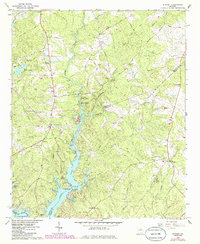
1964 Map of Stewart
USGS Topo · Published 1985About this map
The Alcovy River and Jackson Lake dominate this landscape on the border of Newton, Jasper, and Butts Counties. The topography reveals an intricate network of peninsulas and coves along the northern reach of the lake, including Hardy Neck, Parker Neck, and Kitchen Neck. The presence of Factory Shoals and White Shoals north of the reservoir indicates the river's earlier industrial potential, anchored by the settlement of Newton Factory and its nearby Newton Factory Cem.
Find a feature on this map
75 named features on this map. Tap any name to fly to it.
Don’t see what you’re looking for? This feature index may not catch every label — zoom into the map to look around manually.
Map Details
Editions of this 1964 Stewart Map
3 editions found
Other maps of this area

1896 · Monroe
USGS Topo · 1:125,000

1953 · Athens
USGS Topo · 1:250,000

1958 · Athens
USGS Topo · 1:250,000

1959 · Athens
USGS Topo · 1:250,000

1963 · Athens
USGS Topo · 1:250,000

1964 · Lloyd Shoals Dam
USGS Topo · 1:24,000
1964 · Jackson
USGS Topo · 1:24,000

1964 · Stewart
USGS Topo · 1:24,000

1964 · Worthville
USGS Topo · 1:24,000

1964 · Porterdale
USGS Topo · 1:24,000