
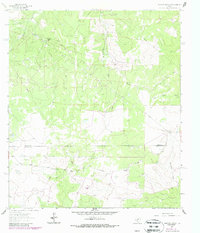
1962 Map of Stewart Ranch
USGS Topo · Published 1966About this map
The boundary between Sutton Co and Edwards Co divides this ranching landscape of the Edwards Plateau during the early 1960s. The terrain is defined by a network of drainage features like Tenmile Draw and Rattlesnake Draw that lead toward the Dry Llano River. Unlike many regions of the country that saw urban sprawl in this era, this area remained dominated by expansive landholdings such as Stewart Ranch, Wade Ranch, and Miers Ranch. Human industry is etched onto the map through the presence of a Pipeline, a Gas Well, and numerous extraction sites labeled Gravel Pit. Movement across the county line is facilitated by the unpaved path of Bond Road, illustrating the sparse, functional transportation network required for isolated West Texas ranching operations.
Find a feature on this map
12 named features on this map. Tap any name to fly to it.
Don’t see what you’re looking for? This feature index may not catch every label — zoom into the map to look around manually.
Map Details
Editions of this 1962 Stewart Ranch Map
2 editions found
Other maps of this area

1893 · Rock Springs
USGS Topo · 1:125,000

1954 · Sonora
USGS Topo · 1:250,000

1958 · Sonora
USGS Topo · 1:250,000
1962 · Bundy Ranch
USGS Topo · 1:24,000

1963 · Steen Lake
USGS Topo · 1:24,000

1963 · Harrison Ranch
USGS Topo · 1:24,000

1963 · Live Oak Draw
USGS Topo · 1:24,000
1963 · Fort Terrett Ranch
USGS Topo · 1:24,000

1970 · Ray Lake NW
USGS Topo · 1:24,000
1971 · Ray Lake
USGS Topo · 1:24,000