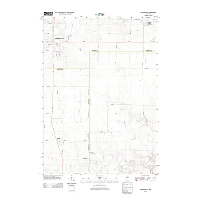
2013 Map of Stewartville
USGS Topo · Published 2013About this map
Stewartville anchor the northwestern corner of this landscape, situated along the North Branch Root River and the shores of Lake Florence. The area is characterized by a dense network of country roads and county lines, where the boundaries of Olmsted, Mower, and Fillmore counties converge. To the east, the settlement of Pleasant Grove sits near the headwaters of Partridge Creek, while the southern reaches feature the small communities of Racine and Hamilton. Genealogical interest is concentrated in the numerous burial grounds scattered throughout the agricultural terrain, including Saint Bernard, Woodlawn, and the Hamilton Congregational Cemetery. The drainage patterns of Kedron Creek and Bear Creek weave between the section lines, illustrating the rural character of this southern Minnesota region.
Find a feature on this map
72 named features on this map. Tap any name to fly to it.
Don’t see what you’re looking for? This feature index may not catch every label — zoom into the map to look around manually.
Map Details
Editions of this 2013 Stewartville Map
This is the sole edition of this map. No revisions or reprints were ever made.
Other maps of this area

1954 · Mason City
USGS Topo · 1:250,000

1955 · Stewartville
USGS Topo · 1:62,500

1955 · High Forest
USGS Topo · 1:62,500

1957 · Mason City
USGS Topo · 1:250,000

1958 · Mason City
USGS Topo · 1:250,000

1965 · Wykoff
USGS Topo · 1:24,000

1965 · Spring Valley
USGS Topo · 1:24,000

1965 · Grand Meadow
USGS Topo · 1:24,000
1974 · High Forest
USGS Topo · 1:24,000
1974 · Salem Corners
USGS Topo · 1:24,000