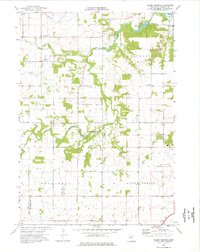
1974 Map of Salem Corners
USGS Topo · Published 1976About this map
The South Fork Zumbro River winds through the heart of this landscape, anchoring a region defined by agricultural plots and conservation efforts in the mid-1970s. The small settlement of Salem Corners serves as a local crossroads, while the Rochester Municipal Airport dominates the southeastern corner, signaling the expanding infrastructure of the neighboring city. Rural education and local history are preserved in the locations of Bamber Valley Sch and Dee Sch, alongside the Riverside Cem near the riverbank.
Find a feature on this map
18 named features on this map. Tap any name to fly to it.
Don’t see what you’re looking for? This feature index may not catch every label — zoom into the map to look around manually.
Map Details
Editions of this 1974 Salem Corners Map
2 editions found
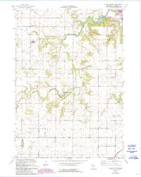
Other maps of this area

1935 · Rochester
USGS Topo · 1:48,000

1939 · Rochester
USGS Topo · 1:62,500

1953 · Saint Paul
USGS Topo · 1:250,000

1954 · Mason City
USGS Topo · 1:250,000

1955 · Stewartville
USGS Topo · 1:62,500

1955 · High Forest
USGS Topo · 1:62,500

1957 · Mason City
USGS Topo · 1:250,000

1958 · Mason City
USGS Topo · 1:250,000

1959 · Saint Paul
USGS Topo · 1:250,000

1965 · Byron
USGS Topo · 1:24,000