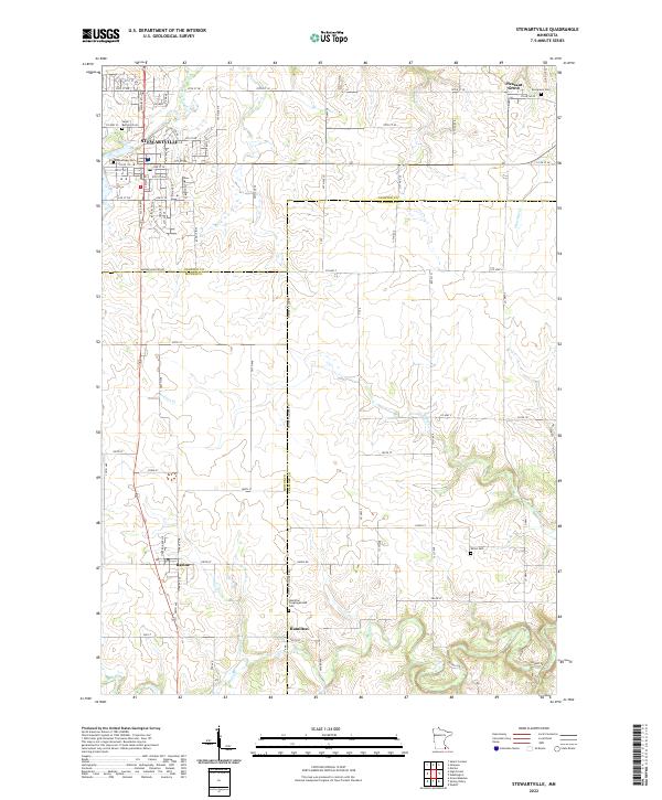
2022 Map of Stewartville
USGS Topo · Published 2022About this map
Stewartville serves as the primary hub in this southern Minnesota landscape, where the agricultural plains are etched by the winding course of the North Branch Root River. The survey documents a region defined by its rural crossroads and boundary lines, where the borders of Olmsted, Fillmore, and Mower Counties meet. The settlement of Racine sits at a critical junction to the south, while smaller locales like Pleasant Grove and Hamilton anchor the outlying farmstead networks. Genealogy and local history are well-preserved through several established burial grounds, including the Hamilton Congregational Cem, Saint Bernard Cem, and Millet Cem. The terrain is drained by a network of seasonal and permanent waterways, notably Kedron Cr, Bear Cr, and Partridge Cr, which have historically influenced road placement and property divisions. This mapping provides a contemporary record of long-standing township structures like T105N R14W and the enduring road grid that connects these small communities.
Find a feature on this map
37 named features on this map. Tap any name to fly to it.
Don’t see what you’re looking for? This feature index may not catch every label — zoom into the map to look around manually.
Map Details
Editions of this 2022 Stewartville Map
This is the sole edition of this map. No revisions or reprints were ever made.
Other maps of this area

1954 · Mason City
USGS Topo · 1:250,000

1955 · Stewartville
USGS Topo · 1:62,500

1955 · High Forest
USGS Topo · 1:62,500

1957 · Mason City
USGS Topo · 1:250,000

1958 · Mason City
USGS Topo · 1:250,000

1965 · Wykoff
USGS Topo · 1:24,000

1965 · Spring Valley
USGS Topo · 1:24,000

1965 · Grand Meadow
USGS Topo · 1:24,000
1974 · High Forest
USGS Topo · 1:24,000
1974 · Salem Corners
USGS Topo · 1:24,000