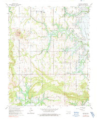
1963 Map of Stidham
USGS Topo · Published 1991About this map
Stidham and the rural communities of Fame and Vivian occupy a landscape undergoing a major hydrological transformation during the early 1960s. The survey captures the McIntosh County terrain as Eufaula Lake begins to fill, with blue hatching indicating large swaths of land destined for submergence by the reservoir. This shifting geography is particularly evident along the valleys of Coon Creek and Possum Creek, where the rising waters of the Canadian River basin redefine the shoreline.
Find a feature on this map
24 named features on this map. Tap any name to fly to it.
Don’t see what you’re looking for? This feature index may not catch every label — zoom into the map to look around manually.
Map Details
Editions of this 1963 Stidham Map
3 editions found
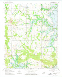
Other maps of this area

1900 · Canadian
USGS Topo · 1:125,000

1946 · Fort Smith
USGS Topo · 1:250,000

1962 · Raiford
USGS Topo · 1:24,000

1962 · Pierce
USGS Topo · 1:24,000

1962 · Hoffman
USGS Topo · 1:24,000

1963 · Stidham
USGS Topo · 1:24,000

1963 · Eufaula
USGS Topo · 1:24,000

1963 · Checotah
USGS Topo · 1:24,000

1965 · Fort Smith
USGS Topo · 1:250,000

1967 · Fort Smith
USGS Topo · 1:250,000