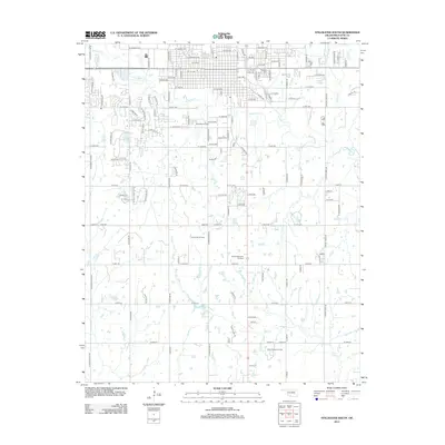
2013 Map of Stillwater South
USGS Topo · Published 2013About this map
The Oklahoma State Univ Main Campus serves as a northern anchor for this landscape, where the southern reaches of Stillwater transition into a region defined by energy extraction and drainage networks. Multiple active production areas including the Stillwater Oil Field, Lost Creek Oil Field, and North Perkins Oil Field are dispersed throughout the countryside, illustrating the ongoing importance of the petroleum industry to the local economy. The terrain is carved by the winding paths of Stillwater Cr and Boomer Cr, while more secluded waterways like Lost Cr flow near the distinct geographic feature of Pickles Gap. For those researching local history or genealogy, the map identifies significant sites such as Fairlawn Cem and the Sunset Memorial Gardens, alongside recreational points like Cedar Isle Lake.
Find a feature on this map
123 named features on this map. Tap any name to fly to it.
Don’t see what you’re looking for? This feature index may not catch every label — zoom into the map to look around manually.
Map Details
Editions of this 2013 Stillwater South Map
This is the sole edition of this map. No revisions or reprints were ever made.
Other maps of this area

1893 · Stillwater
USGS Topo · 1:62,500

1908 · Agra
USGS Topo · 1:62,500

1909 · Perkins
USGS Topo · 1:62,500

1929 · Ripley
USGS Topo · 1:62,500

1932 · Ripley
USGS Topo · 1:62,500

1954 · Oklahoma City
USGS Topo · 1:250,000

1955 · Enid
USGS Topo · 1:250,000

1957 · Oklahoma City
USGS Topo · 1:250,000

1958 · Enid
USGS Topo · 1:250,000

1963 · Oklahoma City
USGS Topo · 1:250,000