
1948 Map of Stillwater
USGS Topo · Published 1962About this map
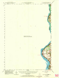
The St Croix River serves as the focal point of this late 1940s survey, marking the jagged boundary between Minnesota and Wisconsin. While the western side of the river remains largely blank in this specific sheet, the eastern shore in Wisconsin shows the developing settlements of Houlton and North Hudson. The landscape is defined by the steep bluffs overlooking the river valley, where local travel was still influenced by river crossings like the Marine Ferry further north. The map reveals the early twentieth-century layout of small river-valley communities before later suburban expansion. Notable local landmarks include the Houlton Cem, a Boy Scout Camp along the riverbanks, and a Tower situated on the high ground overlooking Lake St Croix. The transition from rural township lands in Somerset and St Joseph to the more concentrated village centers reflects the traditional river-and-rail economy of the era.
Find a feature on this map
19 named features on this map. Tap any name to fly to it.
Don’t see what you’re looking for? This feature index may not catch every label — zoom into the map to look around manually.
Map Details
Editions of this 1948 Stillwater Map
2 editions found
Other maps of this area

1896 · St. Paul
USGS Topo · 1:62,500

1900 · St Croix Dalles
USGS Topo · 1:62,500

1901 · St Croix Dalles
USGS Topo · 1:62,500

1902 · White Bear
USGS Topo · 1:62,500

1946 · Hudson
USGS Topo · 1:62,500

1946 · River Falls
USGS Topo · 1:62,500

1948 · New Richmond
USGS Topo · 1:62,500

1949 · New Richmond
USGS Topo · 1:62,500

1949 · River Falls
USGS Topo · 1:62,500

1949 · Hudson
USGS Topo · 1:62,500