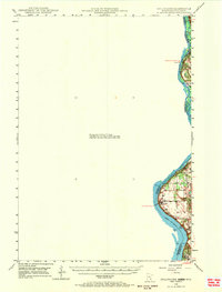
1948 Map of Stillwater
USGS Topo · Published 1969About this map
The St Croix River serves as the defining corridor for this mid-century survey, acting as both a natural boundary and a primary navigational artery. The river transitions into the wider Lake St Croix toward the south, where the village of North Hudson sits along the eastern shore. This 1940s landscape is characterized by its interstate border crossings, where smaller settlements like Houlton and the Marine Ferry crossing point connect the Minnesota and Wisconsin shorelines. Local history is anchored by landmarks such as the Houlton Cem and a prominent Tower on the Wisconsin side, which overlook the valley. The presence of ferry points and cemetery locations suggests a landscape where older modes of river-based transit were still recorded alongside the development of small riverside communities and township grids.
Find a feature on this map
10 named features on this map. Tap any name to fly to it.
Don’t see what you’re looking for? This feature index may not catch every label — zoom into the map to look around manually.
Map Details
Editions of this 1948 Stillwater Map
2 editions found
Other maps of this area

1896 · St. Paul
USGS Topo · 1:62,500

1900 · St Croix Dalles
USGS Topo · 1:62,500

1901 · St Croix Dalles
USGS Topo · 1:62,500

1902 · White Bear
USGS Topo · 1:62,500

1946 · Hudson
USGS Topo · 1:62,500

1946 · River Falls
USGS Topo · 1:62,500

1948 · New Richmond
USGS Topo · 1:62,500

1948 · Stillwater
USGS Topo · 1:62,500

1949 · New Richmond
USGS Topo · 1:62,500

1949 · River Falls
USGS Topo · 1:62,500