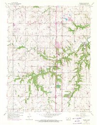
1956 Map of Stilwell
USGS Topo · Published 1971About this map
Agricultural roots and early suburban expansion define this 1950s landscape in southern Johnson County. The Blue River and its many tributaries, including Wolf Creek and Coffee Creek, carve through the terrain where the townships of Oxford and Aubry meet. Small settlements like Stilwell, Stanley, and Morse serve as local hubs, while the presence of the Johnson County Airport and the Mission Road Landing Strip indicates the area's growing connection to aviation and regional transit.
Find a feature on this map
22 named features on this map. Tap any name to fly to it.
Don’t see what you’re looking for? This feature index may not catch every label — zoom into the map to look around manually.
Map Details
Editions of this 1956 Stilwell Map
4 editions found

Other maps of this area

1887 · Olathe
USGS Topo · 1:125,000

1893 · Olathe
USGS Topo · 1:125,000

1934 · Grandview
USGS Topo · 1:24,000

1935 · Olathe
USGS Topo · 1:24,000

1935 · Lenexa
USGS Topo · 1:24,000

1939 · Grandview
USGS Topo · 1:31,680

1943 · Lenexa
USGS Topo · 1:31,680

1943 · Olathe
USGS Topo · 1:31,680

1947 · Lawrence
USGS Topo · 1:250,000

1950 · Lawrence
USGS Topo · 1:250,000