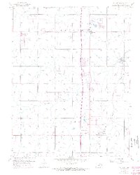
1956 Map of Stilwell
USGS Topo · Published 1971About this map
Stanley and Stilwell anchor this mid-century look at the developing landscape of southern Johnson County, where agriculture and early suburban infrastructure meet. The Missouri Pacific railroad cuts through the eastern edge, serving the small community of Redel, while the Blue River and its tributaries like Negro Creek and Wolf Creek define the natural drainage. Local history is deeply rooted in the rural landscape, marked by the Pleasant Valley Cem and Wea Cem. Purple revisions from 1970 illustrate the early stages of rapid change, including the appearance of the Johnson County Airport and the Mission Road Landing Strip. The presence of a solitary Oil Well and several Quarry sites suggests a mix of natural resource extraction alongside the establishment of community amenities like a Golf Course and Campground.
Find a feature on this map
26 named features on this map. Tap any name to fly to it.
Don’t see what you’re looking for? This feature index may not catch every label — zoom into the map to look around manually.
Map Details
Editions of this 1956 Stilwell Map
4 editions found

Other maps of this area

1887 · Olathe
USGS Topo · 1:125,000

1893 · Olathe
USGS Topo · 1:125,000

1934 · Grandview
USGS Topo · 1:24,000

1935 · Olathe
USGS Topo · 1:24,000

1935 · Lenexa
USGS Topo · 1:24,000

1939 · Grandview
USGS Topo · 1:31,680

1943 · Lenexa
USGS Topo · 1:31,680

1943 · Olathe
USGS Topo · 1:31,680

1947 · Lawrence
USGS Topo · 1:250,000

1950 · Lawrence
USGS Topo · 1:250,000