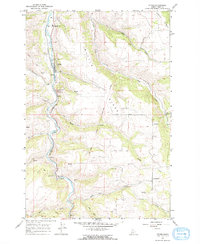
1966 Map of Stites
USGS Topo · Published 1968About this map
The South Fork Clearwater River carves a deep valley through this Idaho landscape, where the settlement of Stites sits along the riverbanks near the northern edge of the Nez Perce Indian Reservation Boundary. This 1960s survey records a terrain defined by significant elevation changes, from the alluvial floor of the Camas Prairie to the high ground of Tahoe Ridge and Battle Ridge. A notable concentration of local history is preserved here, including the Clearwater Battlefield Site and several burial grounds like Indian Cem and Stites Cem. The map captures the area as a junction of natural resources and education, evidenced by the Clearwater Valley High Sch and a series of extractive sites like a Quarry and Gravel Pit. Numerous seasonal water sources, including Sally Creek and Ann Creek, feed into the river system, supporting a network of trails and jeep roads that navigate the complex topography around landmarks like Dizzy Head.
Find a feature on this map
40 named features on this map. Tap any name to fly to it.
Don’t see what you’re looking for? This feature index may not catch every label — zoom into the map to look around manually.
Map Details
Editions of this 1966 Stites Map
2 editions found
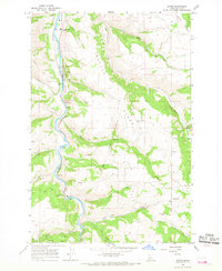
Other maps of this area

1924 · Kamiah
USGS Topo · 1:125,000

1924 · Weippe
USGS Topo · 1:125,000

1931 · Buffalo Hump
USGS Topo · 1:125,000

1934 · Buffalo Hump
USGS Topo · 1:125,000

1955 · Pullman
USGS Topo · 1:250,000

1955 · Grangeville
USGS Topo · 1:250,000

1956 · Elk City
USGS Topo · 1:250,000

1956 · Hamilton
USGS Topo · 1:250,000

1958 · Pullman
USGS Topo · 1:250,000

1959 · Grangeville
USGS Topo · 1:250,000