2022 Map of Stockdale
USGS Topo · Published 2022About this map
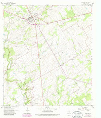
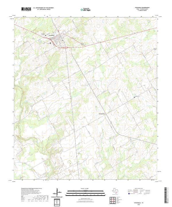
The town of Stockdale serves as the focal point of this South Texas landscape, where a grid of streets like W Main St and S 9th St gives way to a sprawling network of rural county roads. The area's cultural history is anchored by the Saint Marys Catholic Church and its associated Saint Marys Catholic Church Cem, alongside the Stockdale Cem on the town’s western edge. Southward, the terrain is defined by the winding course of Cibolo Cr and the smaller settlement of Denhawken, which maintains its own historic Denhawken Cem. This modern survey illustrates the persistent agricultural and ranching layout of Wilson County, showing how drainage features like Clifton Br and Dry Cr dictate the placement of local routes. Landmarks such as Bailey Airport and Moy's Lndg provide specific points of interest for local researchers and genealogists tracing property and family ties in the region.
Find a feature on this map
53 named features on this map. Tap any name to fly to it.
Don’t see what you’re looking for? This feature index may not catch every label — zoom into the map to look around manually.
Map Details
Editions of this 2022 Stockdale Map
This is the sole edition of this map. No revisions or reprints were ever made.