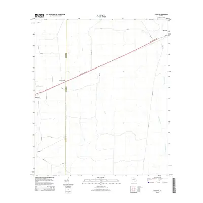
2014 Map of Stockton
USGS Topo · Published 2014About this map
Stockton and Du Pont anchor this South Georgia landscape along the border of Lanier and Clinch Counties. The primary transportation corridor is defined by Us-84 and the Downing Musgrove Parkway, which cut a straight line northeast through the timberlands and wetlands characteristic of the region. This survey captures a moment of modern rural continuity, where traditional settlement clusters like Greenwood remain centered near the highway while much of the terrain is defined by an intricate network of local farm-to-market roads.
Find a feature on this map
27 named features on this map. Tap any name to fly to it.
Don’t see what you’re looking for? This feature index may not catch every label — zoom into the map to look around manually.
Map Details
Editions of this 2014 Stockton Map
This is the sole edition of this map. No revisions or reprints were ever made.
Other maps of this area

1953 · Waycross
USGS Topo · 1:250,000

1954 · Valdosta
USGS Topo · 1:250,000

1958 · Valdosta
USGS Topo · 1:250,000

1958 · Waycross
USGS Topo · 1:250,000

1959 · Valdosta
USGS Topo · 1:250,000

1968 · Naylor
USGS Topo · 1:24,000

1968 · Lakeland
USGS Topo · 1:24,000

1971 · Thelma
USGS Topo · 1:24,000

1971 · Howell
USGS Topo · 1:24,000

1971 · Du Pont
USGS Topo · 1:24,000