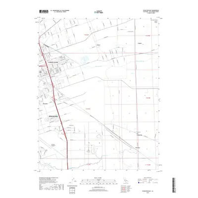
2018 Map of Stockton East
USGS Topo · Published 2018About this map
The eastern edges of Stockton meet the fertile agricultural plains of the Central Valley in this 2018 topographic study. Urban expansion is visible in neighborhoods like Garden Acres, Fair Oaks, and Kennedy, which transition into a landscape of irrigation canals and drainage systems critical to the region's productivity. The Stockton Diverting Canal and Mormon Slough cut through the terrain, managing water flow across a valley floor marked by several smaller seasonal channels such as Duck Creek.
Find a feature on this map
151 named features on this map. Tap any name to fly to it.
Don’t see what you’re looking for? This feature index may not catch every label — zoom into the map to look around manually.
Map Details
Editions of this 2018 Stockton East Map
This is the sole edition of this map. No revisions or reprints were ever made.
Other maps of this area

1894 · Lodi
USGS Topo · 1:125,000

1908 · Waterloo
USGS Topo · 1:31,680

1908 · Linden
USGS Topo · 1:31,680

1910 · Castle
USGS Topo · 1:31,680

1913 · Stockton
USGS Topo · 1:31,680

1914 · Burnham
USGS Topo · 1:31,680

1914 · Manteca
USGS Topo · 1:31,680

1914 · Avena
USGS Topo · 1:31,680

1915 · Lathrop
USGS Topo · 1:31,680

1915 · Peters
USGS Topo · 1:31,680