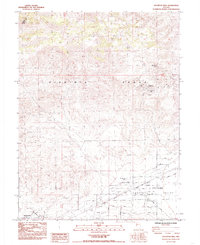
1985 Map of Stockton Well
USGS Topo · Published 1985About this map
The Virginia Range dominates the northern half of this Nevada landscape, where the legacy of desert extraction is visible through the Tapaloosa (Mining District) and various mining operations like the Christianson Shaft and Dyke Adit. To the south, the terrain descends into Churchill Valley and the expansive Stockton Flat, areas defined by their intersection of pioneer history and mid-century residential planning. The historic Emigrant Trail traverses the valley floor, cutting through a grid of named streets such as California Ave and Dayton Ave that mark the growth of Silver Springs. This settlement, along with Stagecoach further west, reflects the transition from early mining and ranching outposts like Stockton Well and Rock Blind Spring to a more permanent rural community serviced by the Lahontan Airstrip and regional water infrastructure.
Find a feature on this map
55 named features on this map. Tap any name to fly to it.
Don’t see what you’re looking for? This feature index may not catch every label — zoom into the map to look around manually.
Map Details
Editions of this 1985 Stockton Well Map
2 editions found
Other maps of this area

1890 · Wadsworth
USGS Topo · 1:125,000

1891 · Wabuska
USGS Topo · 1:125,000

1892 · Wadsworth
USGS Topo · 1:125,000

1894 · Wadsworth
USGS Topo · 1:125,000

1894 · Wabuska
USGS Topo · 1:125,000

1957 · Churchill Butte
USGS Topo · 1:62,500

1957 · Two Tips
USGS Topo · 1:62,500

1957 · Wadsworth
USGS Topo · 1:62,500

1957 · Silver Springs
USGS Topo · 1:62,500

1957 · Reno
USGS Topo · 1:250,000