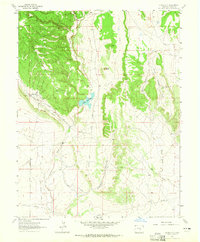
1963 Map of Stone City
USGS Topo · Published 1965About this map
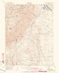
Stone City sits at the foot of Booth Mountain on this mid-1960s survey, a landscape defined by its industrial history and drainage patterns. The settlement is linked to the surrounding terrain by the Stone City Road and an Old Railroad Grade that winds through Booth Gulch, signaling the area's former reliance on heavy transport. A quarry near the town center provides a direct link to the local economy, while the Colorado School of Mines Summer Camp in Wild Horse Park suggests the area's long-standing importance for geological study. Water management is central to the local geography, with Turkey Creek flowing into Teller Reservoir and the drainage of Pumpkin Hollow and Wild Horse Creek carving paths through the high plains. Large landholdings like the Turkey Creek Ranch characterize the open space between these geological features.
Find a feature on this map
16 named features on this map. Tap any name to fly to it.
Don’t see what you’re looking for? This feature index may not catch every label — zoom into the map to look around manually.
Map Details
Editions of this 1963 Stone City Map
4 editions found
Other maps of this area

1891 · Pueblo
USGS Topo · 1:125,000

1893 · Colorado Springs
USGS Topo · 1:125,000

1894 · Pueblo
USGS Topo · 1:125,000

1896 · Pueblo
USGS Topo · 1:125,000

1897 · Pueblo
USGS Topo · 1:125,000

1909 · Colorado Springs
USGS Topo · 1:125,000

1942 · Colorado Springs
USGS Topo · 1:125,000

1948 · Mount Pittsburg
USGS Topo · 1:24,000

1948 · Timber Mountain
USGS Topo · 1:24,000
1948 · Mount Big Chief
USGS Topo · 1:62,500