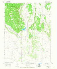
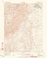
1963 Map of Stone City
USGS Topo · Published 1968About this map
Stone City stands as the primary settlement in this 1963 survey of the Colorado-Pueblo county line area, where the rugged terrain of Booth Mountain meets the drainage basins of Turkey Creek and Wild Horse Creek. The landscape is a mix of ranching operations and technical outposts, featuring the Turkey Creek Ranch and the Colorado School of Mines Summer Camp situated near the eastern edge of the quadrangle. Industrial activity is evidenced by a Quarry and various Mines, connected by an Old Railroad Grade that winds through Booth Gulch. Water management is central to the area's geography, with the Teller Reservoir and the Teller Ditch providing critical infrastructure alongside local landmarks like the homestead of John Palmer. This map illustrates the transition from high-elevation landforms like White Butte to the lower reaches of Pumpkin Hollow and Steel Hollow.
Find a feature on this map
18 named features on this map. Tap any name to fly to it.
Don’t see what you’re looking for? This feature index may not catch every label — zoom into the map to look around manually.
Map Details
Editions of this 1963 Stone City Map
4 editions found
Other maps of this area

1891 · Pueblo
USGS Topo · 1:125,000

1893 · Colorado Springs
USGS Topo · 1:125,000

1894 · Pueblo
USGS Topo · 1:125,000

1896 · Pueblo
USGS Topo · 1:125,000

1897 · Pueblo
USGS Topo · 1:125,000

1909 · Colorado Springs
USGS Topo · 1:125,000

1942 · Colorado Springs
USGS Topo · 1:125,000

1948 · Mount Pittsburg
USGS Topo · 1:24,000

1948 · Timber Mountain
USGS Topo · 1:24,000
1948 · Mount Big Chief
USGS Topo · 1:62,500