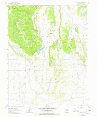
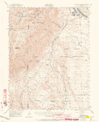
1963 Map of Stone City
USGS Topo · Published 1978About this map
Stone City and the surrounding Fort Carson Military Reservation dominate this landscape during the mid-1960s, reflecting a mix of defense land use and rugged high-plains geography. The settlement at Stone City is marked by industrial remnants like a Quarry and an Old Railroad Grade, which suggests the area's history of resource extraction. Significant water management is evident through the Teller Ditch and the Teller Reservoir, which anchor the drainage of Turkey Creek. Education and field research are also present in the landscape at the Colorado School of Mines Summer Camp located near Wild Horse Creek. Further south, the topography transitions toward Pumpkin Hollow and includes family-named landmarks such as the Turkey Creek Ranch and the John Palmer homestead, offering a detailed view of Pueblo County's rural and institutional development during this era.
Find a feature on this map
21 named features on this map. Tap any name to fly to it.
Don’t see what you’re looking for? This feature index may not catch every label — zoom into the map to look around manually.
Map Details
Editions of this 1963 Stone City Map
4 editions found
Other maps of this area

1891 · Pueblo
USGS Topo · 1:125,000

1893 · Colorado Springs
USGS Topo · 1:125,000

1894 · Pueblo
USGS Topo · 1:125,000

1896 · Pueblo
USGS Topo · 1:125,000

1897 · Pueblo
USGS Topo · 1:125,000

1909 · Colorado Springs
USGS Topo · 1:125,000

1942 · Colorado Springs
USGS Topo · 1:125,000

1948 · Mount Pittsburg
USGS Topo · 1:24,000

1948 · Timber Mountain
USGS Topo · 1:24,000
1948 · Mount Big Chief
USGS Topo · 1:62,500