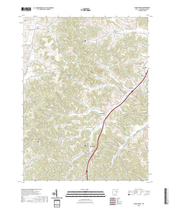
2023 Map of Stone Creek
USGS Topo · Published 2023About this map
Stone Creek and the surrounding township terrain in Tuscarawas County are defined by a network of ridge roads and small settlements that speak to the area's agricultural and rural heritage. The landscape is dotted with significant genealogical sites, including the Saint Johns German Reformed Cem and the Jerusalem Reformed Cem, which reflect the ancestral roots of the local community. Further south, the Saint Jacobs Reformed Cem sits near Angel Valley, while the eponymous Stonecreek Cem is located just outside the main village. Water features such as Marsh Pond and the Cross Cr Coal Company Reservoir hint at the local water management and industrial needs of the region. Small clusters like Blackband and Yorktown remain linked by historical routes such as Co Hwy 50 and Steinerey Ridge Rd NW, maintaining the spatial character of this part of Ohio.
Find a feature on this map
105 named features on this map. Tap any name to fly to it.
Don’t see what you’re looking for? This feature index may not catch every label — zoom into the map to look around manually.
Map Details
Editions of this 2023 Stone Creek Map
This is the sole edition of this map. No revisions or reprints were ever made.
Other maps of this area

1909 · Uhrichsville
USGS Topo · 1:62,500

1911 · Uhrichsville
USGS Topo · 1:62,500

1911 · Newcomerstown
USGS Topo · 1:62,500

1912 · Dover
USGS Topo · 1:62,500

1913 · Newcomerstown
USGS Topo · 1:62,500

1914 · Navarre
USGS Topo · 1:62,500

1943 · Newcomerstown
USGS Topo · 1:62,500

1944 · Navarre
USGS Topo · 1:62,500

1944 · Dover
USGS Topo · 1:62,500

1951 · Canton
USGS Topo · 1:250,000