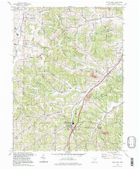
1994 Map of Stone Creek
USGS Topo · Published 1998About this map
Stone Creek and the surrounding townships of Auburn, Dover, and York are mapped here as they appeared in the mid-1990s. The landscape is defined by the narrow valleys of Crooked Run and Angel Valley, where small rural communities and family-named roads like Andrews Road and Stucky Valley Road illustrate the region's long-established settlement patterns. This area within the United States Military District maintains a strong spiritual and community foundation, evidenced by numerous historic congregations including St Johns Ch and St Jacobs Ch.
Find a feature on this map
48 named features on this map. Tap any name to fly to it.
Don’t see what you’re looking for? This feature index may not catch every label — zoom into the map to look around manually.
Map Details
Editions of this 1994 Stone Creek Map
This is the sole edition of this map. No revisions or reprints were ever made.
Other maps of this area

1909 · Uhrichsville
USGS Topo · 1:62,500

1911 · Uhrichsville
USGS Topo · 1:62,500

1911 · Newcomerstown
USGS Topo · 1:62,500

1912 · Dover
USGS Topo · 1:62,500

1913 · Newcomerstown
USGS Topo · 1:62,500

1914 · Navarre
USGS Topo · 1:62,500

1943 · Newcomerstown
USGS Topo · 1:62,500

1944 · Navarre
USGS Topo · 1:62,500

1944 · Dover
USGS Topo · 1:62,500

1951 · Canton
USGS Topo · 1:250,000