
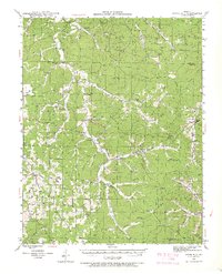
1941 Map of Stone Hill
USGS Topo · Published 1958About this map
The Meramec River carves through the Ozark landscape of Dent County in the early 1940s, framing a region defined by its narrow valleys and dispersed rural communities. This survey reveals a high density of one-room schoolhouses such as Simmons Sch, Young Sch, and New Home Sch, reflecting the decentralized education system of the pre-consolidation era. At Howes Mill P O, the eponymous Howes Mill stands as a local landmark near the Water Fork junction, serving as a social and economic anchor for the surrounding hollows.
Find a feature on this map
59 named features on this map. Tap any name to fly to it.
Don’t see what you’re looking for? This feature index may not catch every label — zoom into the map to look around manually.
Map Details
Editions of this 1941 Stone Hill Map
3 editions found
Other maps of this area

1928 · Meramec Spring
USGS Topo · 1:62,500

1932 · Steelville
USGS Topo · 1:48,000

1932 · Cedar Grove
USGS Topo · 1:48,000

1933 · Steelville
USGS Topo · 1:62,500

1937 · Steelville
USGS Topo · 1:62,500

1941 · Salem
USGS Topo · 1:62,500

1943 · Berryman
USGS Topo · 1:62,500

1943 · Boss
USGS Topo · 1:62,500

1944 · Corridon
USGS Topo · 1:62,500

1945 · Salem
USGS Topo · 1:62,500