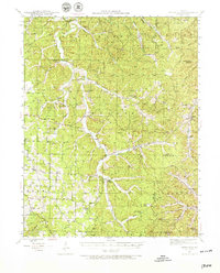
1941 Map of Stone Hill
USGS Topo · Published 1966About this map
Short Bend sits along the winding watercourses of the Ozark Plateau in this mid-century portrait of Dent County. The settlement of Stone Hill serves as a primary reference point in a landscape defined by sharp topographical relief and the intricate drainage patterns of the Missouri interior. These small communities, mapped in the early 1940s, reflect the rural persistence of the region before significant modern highway development altered the traditional connectivity of the hollows and ridges. The map emphasizes the isolation and specific placement of these hamlets within the complex river and valley systems of the southern Missouri highlands.
Find a feature on this map
2 named features on this map. Tap any name to fly to it.
Don’t see what you’re looking for? This feature index may not catch every label — zoom into the map to look around manually.
Map Details
Editions of this 1941 Stone Hill Map
3 editions found
Other maps of this area

1928 · Meramec Spring
USGS Topo · 1:62,500

1932 · Steelville
USGS Topo · 1:48,000

1932 · Cedar Grove
USGS Topo · 1:48,000

1933 · Steelville
USGS Topo · 1:62,500

1937 · Steelville
USGS Topo · 1:62,500

1941 · Salem
USGS Topo · 1:62,500

1941 · Stone Hill
USGS Topo · 1:62,500

1943 · Berryman
USGS Topo · 1:62,500

1943 · Boss
USGS Topo · 1:62,500

1944 · Corridon
USGS Topo · 1:62,500