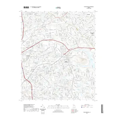
2020 Map of Stone Mountain
USGS Topo · Published 2020About this map
Stone Mtn dominates the eastern landscape, a massive geological formation surrounded by a network of water features including Stone Mountain Lake, Howell Lake, and Rockbridge Lake. This 2020 survey illustrates the high density of the DeKalb Co and Gwinnett Co suburbs, where established communities like Tucker, Clarkston, and Stone Mountain are unified by major thoroughfares such as the Stone Mountain Hwy and Memorial Drive. The area is a significant educational and civic hub, housing the Georgia State University Perimeter College Clarkston Campus and Georgia Piedmont Technical College, alongside the Camp Circle Court Complex. Genealogists and local historians can locate several burial grounds, from the Rehoboth Cem and Melwood Cem to the sprawling Floral Hills Memory Gardens, documenting the region's long-standing residential development and community centers.
Find a feature on this map
65 named features on this map. Tap any name to fly to it.
Don’t see what you’re looking for? This feature index may not catch every label — zoom into the map to look around manually.
Map Details
Editions of this 2020 Stone Mountain Map
This is the sole edition of this map. No revisions or reprints were ever made.
Other maps of this area

1888 · Atlanta
USGS Topo · 1:125,000

1890 · Atlanta
USGS Topo · 1:125,000

1892 · Atlanta
USGS Topo · 1:125,000

1895 · Atlanta
USGS Topo · 1:125,000

1953 · Atlanta
USGS Topo · 1:250,000

1954 · Conley
USGS Topo · 1:24,000

1954 · Chamblee
USGS Topo · 1:24,000

1954 · Decatur
USGS Topo · 1:24,000

1956 · Stone Mountain
USGS Topo · 1:24,000

1956 · Snellville
USGS Topo · 1:24,000